CHIAPA DE CORZO
By Dr. Joseph
L. Allen and Blake J. Allen
Introduction
The
ruins of Chiapa de Corzo are located in the lower Grijalva valley, also called
the Central Chiapas Depression, in the state of Chiapas, Mexico. The size of
the Chiapas depression (land of Zarahemla) from the proposed cities of
Ammonihah (Jiquipilas) to Manti (Ciudad Cuauhtemoc) is comparable in size to
the ancient land of Israel from the cities of Dan to Beersheba. It is as if
someone took a giant bulldozer and scooped the dirt out of the center of the
land of Chiapas, casting it up on both sides to create a long valley 150 miles
long by 30 miles wide. You can literally superimpose the ancient land of Israel
over the Chiapas depression map as they are geographically the same size. In
this scenario, just like the city of Jerusalem is located in the center of the
land of Israel, so is the city of Zarahemla (Santa Rosa) located in the center
of the land of Chiapas. The Grijalva river that runs through the depression has
four constructed dams along its path, the Malpaso, the Chicoasén (the tallest
dam in North America), the Angostura, and the Peñitas dams. Electricity
generated from the dams provides service for a good portion of the country of
Mexico.
In
our opinion, the history and geography of the central depression of the state
of Chiapas is so essential to our understanding of Book of Mormon history and
geography, that any geographical model that does not include Chiapas would severely
lack a balanced concept of Book of Mormon geography. The state of Chiapas is
about two-thirds of the size as the country of Guatemala. Its inclusion within
the country of Mexico was not officially recognized by Guatemala until 1895. Both
Chiapas and Guatemala are Maya. They are of the same indigenous groups. The
discovery of the Miraflores style and workmanship of pottery originating from Lake
Atitlan and Kaminaljuyu in Guatemala dating from the second century BC at Santa
Rosa verifies an emigration relationship from the city of Nephi and the waters of
Mormon to the land of Zarahemla. Chiapas has a higher ratio of indigenous
people than any other state in Mexico.
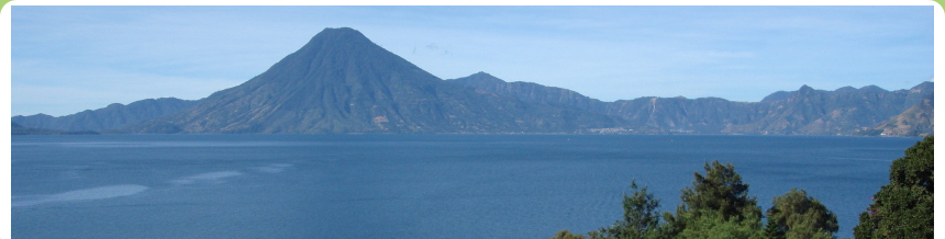
While in Chiapas, a great adventure is to take a
boat ride on the Grijalva River through the majestic Sumidero Canyon. A visit
to the archaeological zone of Chiapa de Corzo and the Regional Museum of
Chiapas at Tuxtla Gutierrez is a must.
An amazing zoo featuring animals indigenous to the state, an evening at
the Marimba park, a visit to the LDS Temple, and a trip to San Cristobal de las
Casas are just a few of the many attractions offered to the visitor who travels
to the beautiful state of Chiapas.
Chiapa
de Corzo
The ruins of Chiapa de Corzo,
located along the banks of the Grijalva River near the cemetery of the city by
the same name, are highly significant in relation to the Book of Mormon. Chiapa
de Corzo is situated on the opposite side of the river from Tuxtla Gutierrez,
the capital city of the state of Chiapas. Like Kaminaljuyu, Tikal, and Izapa,
which all have identifiable language markers on stone, so does Chiapa de Corzo,
who presents its own credentials in the form of engraved stones. Stela 24 at
Chiapa de Corzo manifests a date of 36 BC.
In 2010 a tomb was discovered at
Chiapa de Corzo dating between 700 and 400 BC. Researchers from Mexico and the USA are studying the jade
ornaments, amber, pearls, pyrite and shells, Olmec style spoons and pendants,
among other materials found at the Zoque culture Chiapas de Corzo Tomb 1, which
dates to 700 BCE, in order to understand the trade routes in the region 2,700
years ago. The cache being studied has jade from Guatemala, amber from the Chiapa
de Corzo region, obsidian and pyrite mirrors from the highlands of Chiapas, and
hematite from Oaxaca. The pyramid containing the tomb was in use from 900 BCE
to 600 CE. The male found in the tomb was between 50-60 years old. There was an
infant sacrifice in the tomb, and a male of 18 years of age. A woman was buried
in a neighboring chamber. The male had bracelets and a necklace with jade from
many areas. The amber jewelry the woman is wearing is the oldest designed amber
ever found in Mesoamerica, dating to 700 BCE.
The old name of Chiapa de Corzo is Zactun
(pronounced sock TOON), which means white stone or limestone, has an
abundance of white limestone that is immediately detected as you take the
scenic boat ride on the Grijalva River or see the cut rock along the highways.
Archaeology and the Book of Mormon
If
Kaminaljuyu/Guatemala City and the surrounding area is the land of Nephi and if
the Isthmus of Tehuantepec is the narrow neck of land, then the land of
Zarahemla has to fit somewhere in between. Substantial evidence exists for the
land of Zarahemla and the central depression valley of Chiapas to be one and
the same. The names of Hermounts, Sidon, and Sidom, all three Book of Mormon
names, have been identified in the ancient history and geography of Chiapas,
Mexico.
We
may get some clues about the land of Zarahemla by studying the archaeological history of
the ancient city of Chiapa de Corzo, the ancient
migratory routes from Guatemala
to Chiapas, the traditional recorded history
of the state of Chiapas,
and parallel studies surrounding a narrow strip of wilderness and a narrow neck
of land.
It
was Joseph Smith, who was born in 1805, that stated that the Nephites lived near
the Isthmus of Tehuantepec. And it was John
Lloyd Stephens, also born in 1805, who wrote that a massive east-west narrow
mountain range, a term identifiable in the Book of Mormon as the narrow strip
of wilderness, is a barrier fit to separate worlds.
The
New World Archaeological Foundation (NWAF)
For
more than a half a century the Church of Jesus Christ of Latter-day Saints has
funded archaeological research in Chiapas.
It was initially started by attorney and Church member, Thomas Stuart
Ferguson. For thirty years of its continued
existence, Elder Howard W. Hunter of the Quorum of the Twelve Apostles and
subsequent president of the Church was its managing director. Two sites where archaeological research and
excavation have been carried out by the NWAF are Izapa and Chiapa de Corzo.
Book
of Mormon Geographical Implications
From a Book of Mormon perspective, we know that the land of Zarahemla
was north of the land
of Nephi. We also know
that the land of Nephi was higher in elevation than the land of Zarahemla. Most
importantly, we know from a geological reference that the land of Nephi was
separated from the land of Zarahemla by a narrow strip of wilderness or a
narrow mountain range that ran from the sea east to the sea west. Also, it is of
great importance to understand that both the land of Nephi and the land of
Zarahemla were located in the land southward, meaning southward of a narrow
neck of land which has been identified by most Latter-day Saint Mesoamerican
geographers as the Isthmus of Tehuantepec.
Finally,
the distance in travel time from the city of Nephi to the borders of the land
of Zarahemla is estimated to be less than 30 days. Based on an average of eight
miles a day, that makes the distance from Nephi to Zarahemla no more than 240
miles, the same distance as from Guatemala City to the borders of Chiapas. If
we are correct that the migratory route from Guatemala to Chiapas over the
Cuchumatanes mountain range is the same as the migratory route of the Nephites,
we can then trace the footsteps of eleven Nephite migrations or journeys either
from Nephi to Zarahemla or from Zarahemla to Nephi.
Book
of Mormon Language Implications
1.
The River Sidon is a major river in the Book of Mormon which means fish waters.
The old name of the Grijalva River that runs through the Chiapas depression is
also called fish waters. Some students of Book of Mormon geography still
propose the Usumacinta River, a river about eighty miles to the east of and
parallel to the Grijalva River, as the river Sidon. Several reasons disqualify
the Usumacinta River from being the river Sidon, among which are: (1) the lack
of population settlements along its path at the time required in the Book of
Mormon, and (2) the absence of a viable candidate for the wilderness of
Hermounts. Other reasons for labeling the Grijalva River as the River Sidon are
associated with other geographical statements summarized below.
2.
The day and a half journey is a twelve-mile fortification line or wall
extending from the mountains by Tonala, Chiapas (from the east to west sea) to
the Pacific Ocean by the town of Paredon.
Paredon means a big wall. In essence, this fortification barrier
enabled the armies of the Nephites to hem the Lamanites in on the south so that
they could have no more possession on the north. It was like an immigration check point to keep
the Lamanites, (1) from getting into the land of Zarahemla via the coastal
route, and (2) from going into the land northward through the isthmus or the
narrow neck of land (Alma 22:33-34).
3.
The land of Zarahemla was located southward of the narrow neck of land. The
definition of an isthmus is a narrow neck of land that divides two larger land
masses. Any movement into the land northward required traveling directly north
through the narrow pass located within the Isthmus itself. The land of
Zarahemla was located between the narrow neck of land (the Isthmus of
Tehuantepec), and the narrow strip of wilderness (Los Cuchumatanes).
4.
The city name of Sidom, where Alma blessed Zeezrom, has the same meaning as
Zactun, the old Maya name of Chiapa de Corzo. Both Sidom and Zactun mean white
or limestone. There are literally hundreds of sites in the Grijalva valley
dating to Book of Mormon times. But it is Chiapa de Corzo, with its language
marker showing the date of 36 BC, which helps us understand a crucial event in
the Book of Mormon. This is the time that the Nephites lost control of the land
of Zarahemla to the Lamanites (Helaman 4:4-6). This is the same date that the
Nephites changed their religious headquarters from the city of Zarahemla to the
city of Bountiful.
5. The wilderness of Hermounts is
located west and north of Zarahemla (Alma 2:37) and means wilderness of wild
beasts, with the beautiful and ferocious Jaguar being the most feared wild and
ravenous beast in Chiapas. The wilderness of Tehuantepec is located west and
north of the Chiapas Depression and means, wilderness of wild beasts. The
land southward where the Jaredites hunted wild animals also appears to be the
same area as the wilderness of Hermounts which adds credibility to this hypothesis
(see Ether 10:21).
It
is doubtful that all of the above linguistic similarities are just
coincidental.
Types
and Shadows: Vultures of the Air
A
scripture which is common to all of the standard works of the Church has to do
with fowls of the air or eagles or vultures. Today there is a vulture
refuge in the area of the wilderness of Tehuantepec (Hermounts). In fact, you
cannot travel along the Grijalva River without seeing vultures. There is even a town en route from Tuxtla
Gutierrez to the Isthmus of Tehuantepec called Ocozocoautla, which means the
village of vultures and serpents.
When
Mormon states that the Lamanites and the Amlicites were slain and driven and
they were scattered on the west and on the north and were devoured by those
beasts, and vultures of the air and their bones have been found, and have
been heaped upon the earth, (Alma 2:37-38) he is simply prophesying about our
day.
Their
bones, or carcasses (meaning their history), have been heaped up and recorded
in both the Bible and the Book of Mormon. The story of their lives tells of how
Gods people have been slain and driven and scattered and devoured by wild
beasts (evil people). The Prophet Joseph Smith clarified the meaning of this
prophecy as follows:
Behold, wheresoever the carcass is,
there shall the eagles be gathered together; so likewise shall mine elect be
gathered from the four quarters of the earth. (Joseph Smith Matthew 1:27).
We, as a remnant of Jacob, have been
gathered and, like vultures, have been able to feast upon the words which have
been given to us as a gift from those of old.
The
Church in Tuxtla Gutierrez (Two Deacons)
It
has been a modern miracle to watch the growth of the Church in Chiapas. As we
contemplate that the native people of Chiapas were left in darkness from the
time that Alma preached the gospel to the people of Ammonihah at 74 BC, and
from the time the Nephites were driven out of Sidom (Chiapa de Corzo) at 36 BC,
and were left in darkness from the time the Nephites were driven completely out
of the land of Zarahemla at AD 350, it is heartrending. But then, when we realize
that just a few short years ago, a new generation of missionaries entered into
the village of Chiapa de Corzo (Sidom), a city that had been without the
Priesthood of God for more than 1,600 years, the feelings are poignant indeed.
A
few years ago, there were two deacons who passed the sacrament at a ward in Tuxtla Gutierrez. The
experience was like going back in time to when both the Jaredites and Nephites
met on common ground in the land of Zarahemla. This time, one deacon, large and
robust, having the features of the large Olmec heads that have been discovered,
and the other deacon, a youngster of slight build with facial features of a
Mayan that looked like he just came off the walls at Palenque, offered up the sacraments
of the Lords atonement to members of the Church. Stakes of the church, a mission, and a temple
all bear witness of the fulfilling of prophecy of the gathering of the Remnant
of Jacob in these latter days.